Second powerful quake hit Kahramanmaras, Turkey with 7.5 Magnitude at 13:24 local time on 6th February 2023.
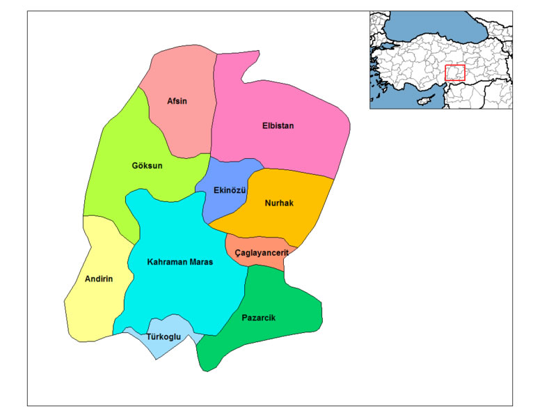
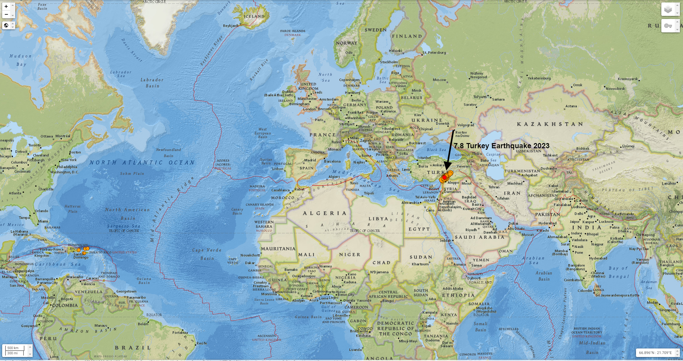
Where is Kahramanmaras on the Map?

- Time: 2023-02-06 13:24:49 (UTC+03:00)
- Location: 38.024°N 37.203°E
- Depth: 10.0 km
Kahramanmaras Turkey Earthquake 2023

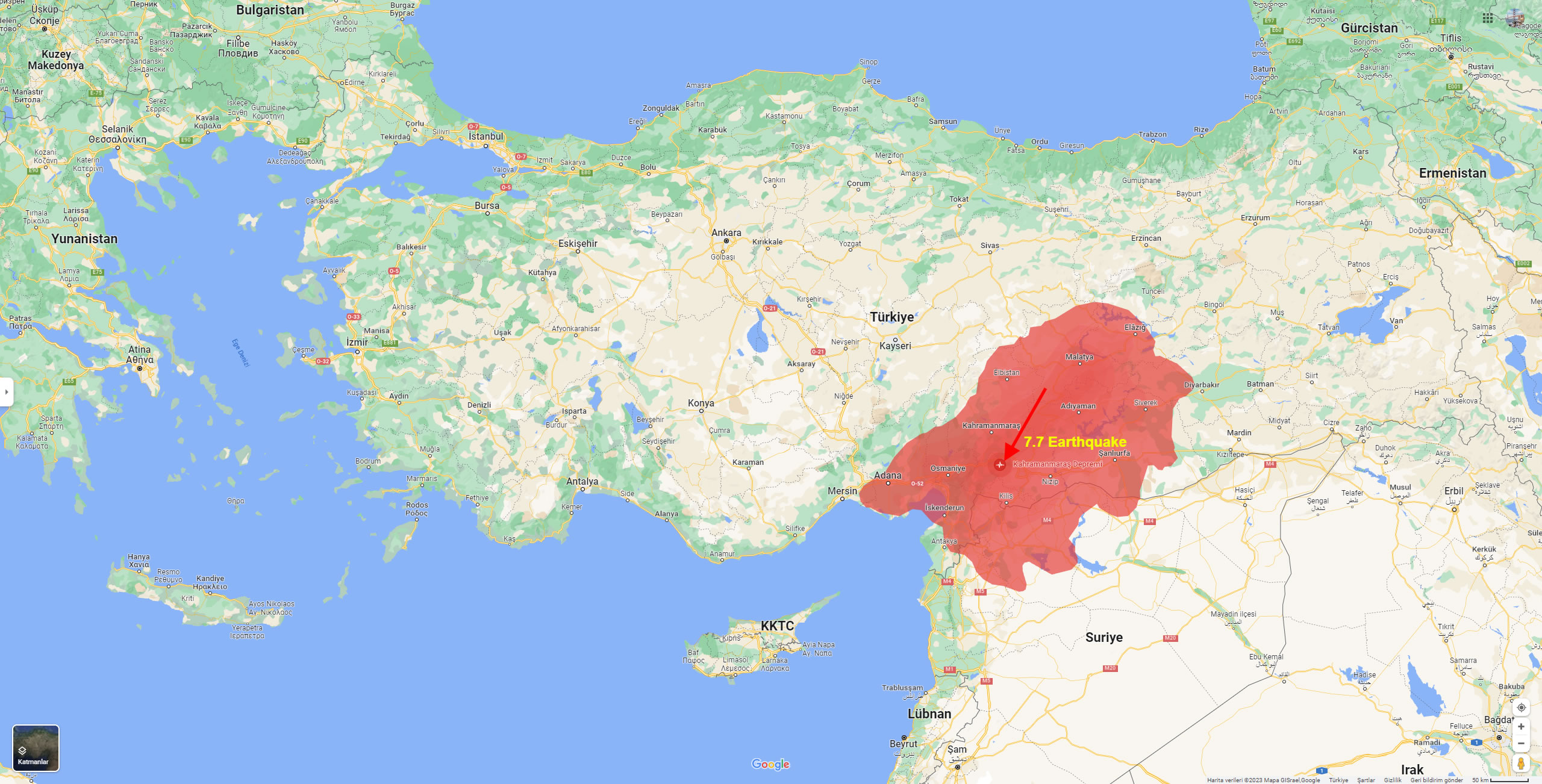
Turkey 7.7 Earthquake 2023 Map
 Here are the 10 largest earthquakes that occurred in Turkey along with their date and estimated loss information:
- August 17, 1999 – Izmit, 7.6 magnitude, approximately 17,000 people killed, 50,000 injured, and hundreds of thousands left homeless.
- November 12, 2020 – Eastern Turkey, 6.8 magnitude, at least 51 people killed, over 1,000 injured.
- March 23, 2010 – Western Turkey, 6.0 magnitude, at least 51 people killed, over 1,000 injured.
- March 3, 1992 – Erzincan, 6.8 magnitude, at least 500 people killed and thousands injured.
- December 27, 1939 – Erzurum, 7.8 magnitude, approximately 30,000 people killed.
- November 1, 1983 – Eastern Turkey, 6.9 magnitude, approximately 1,000 people killed, over 3,000 injured.
- October 20, 2011 – Eastern Turkey, 7.2 magnitude, over 600 people killed, thousands injured.
- August 7, 1999 – Gölcük, 7.4 magnitude, approximately 17,000 people killed and 50,000 injured.
- June 13, 2011 – Van, 7.2 magnitude, over 600 people killed, thousands injured.
- February 5, 1997 – Bolu, 6.3 magnitude, approximately 75 people killed, hundreds injured.
Which Cities Affected by the 2023 Turkey Earthquake
7.8 Magnitude Earthquake Strikes Turkey and Syria
5 Cities Most Affected by the 2023 Turkey Earthquake
7.5 Magnitude Turkey Earthquake Efectes Areas Map
- Map of Turkey
- Syria Map
- Malatya Map
- Kahramanmaras Map
- Gaziantep Map
- Adiyaman Map
- Adana Map
- Mersin Map
- Diyarbakir Map
- Elazig Map
- Hatay Map
- Kayseri Map
- Sivas Map
- Sanliurfa Map
- Kilis Map
- Osmaniye Map
- Aleppo Map
Author: Arif Cagrici – Head of Digital


