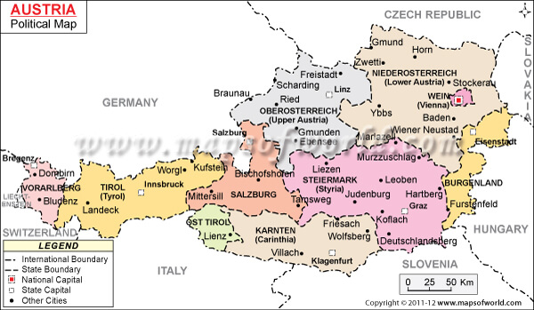
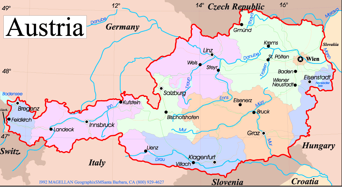
Austria is a landlocked country located in Central Europe. It is bordered by Germany to the northwest, the Czech Republic to the north, Slovakia to the northeast, Hungary to the east, Slovenia and Italy to the south, and Switzerland and Liechtenstein to the west.
Austria is a country located in Central Europe with an area of 83,871 km². It has a population of approximately 8.9 million people, with the majority of the population concentrated in urban areas. The official language is German and the currency is the Euro.
Where is Austria?
A Collection of Austria Maps 4K HD with Calming Music
Austria has a highly developed economy, with a focus on the service sector and a strong manufacturing industry. The country is known for its high standard of living and its well-developed infrastructure. Additionally, Austria is home to several large multinational corporations, as well as a thriving tourism industry.
Map of Austria
In terms of demographics, Austria has a relatively low birth rate and an aging population, which presents challenges for the country’s future economic growth. However, the government has implemented various measures aimed at improving the country’s demographic situation, such as increasing support for families and encouraging immigration.
Austria and Austrian Cities 4K HD with Calming Music by Drone
Austria Tourism
Austria is a beautiful country located in Central Europe that offers visitors a rich cultural heritage, stunning natural scenery, and many opportunities for outdoor activities. Some popular travel destinations in Austria include:
- Vienna: The capital city of Austria, known for its imperial palaces, world-class museums, and beautiful gardens.
- Salzburg: A historic city that was the birthplace of Mozart and is famous for its baroque architecture and beautiful old town.
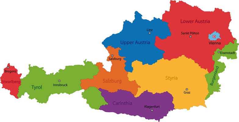
- Tyrol: A scenic region in the Austrian Alps, popular for skiing and other winter sports, as well as for its hiking and outdoor activities in the summer.
- Hallstatt: A charming lakeside village known for its well-preserved medieval architecture and stunning natural beauty.
- Innsbruck: A city located in the heart of the Austrian Alps, famous for its ski resorts, as well as for its medieval and baroque architecture.
The largest cities in the Austria are:
Here are the 10 largest cities in the Austria, ranked by population.
- Vienna (1.9 million)
- Graz (257,000)
- Linz (197,000)
- Salzburg (150,000)
- Innsbruck (127,000)
- Klagenfurt (98,000)
- Villach (57,000)
- Wels (54,000)
- Sankt Pölten (51,000)
- Dornbirn (49,000)
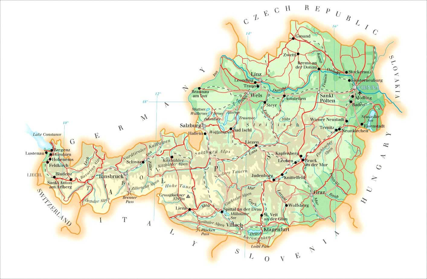
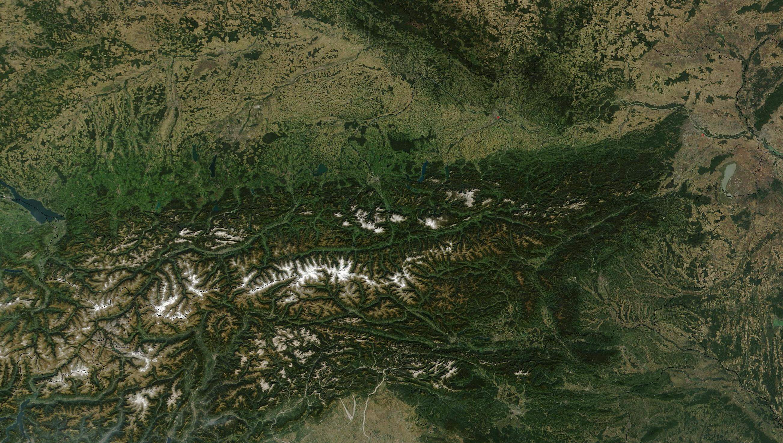
Austria Satellite Map
Author: Arif Cagrici – Head of Digital