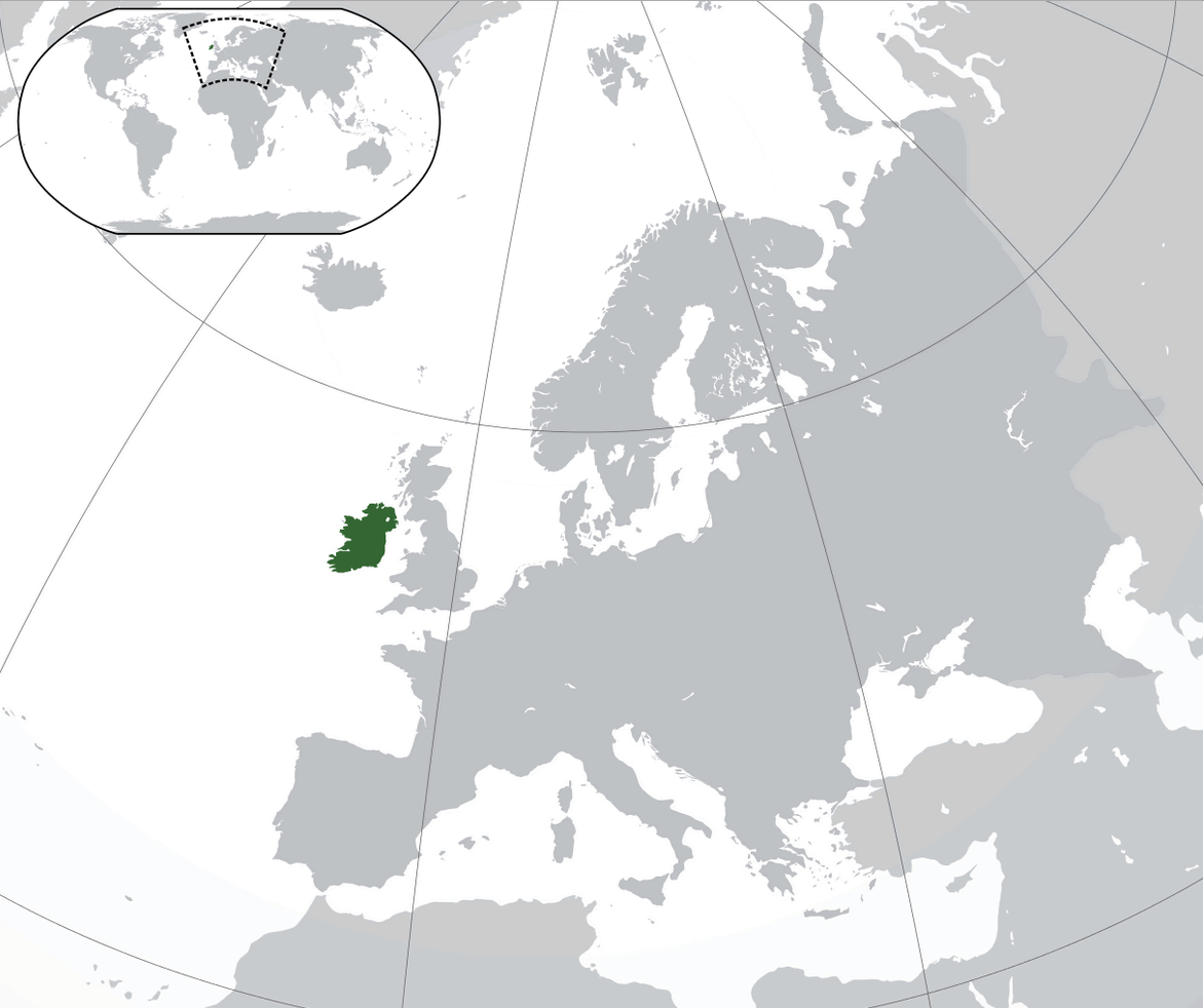
Ireland is an island nation located in northwestern Europe. It is the third-largest island in Europe and the twentieth-largest island in the world. It is located to the northwest of continental Europe and is surrounded by the Atlantic Ocean, the Irish Sea, and the Celtic Sea.
Ireland is an island nation located in northwestern Europe. It is the third-largest island in Europe and the twentieth-largest island in the world. It is located to the northwest of continental Europe and is surrounded by the Atlantic Ocean, the Irish Sea, and the Celtic Sea.
Where is Ireland?
Ireland is located in Western Europe, and is made up of the island of Ireland, which includes the Republic of Ireland and Northern Ireland. The Republic of Ireland has a population of approximately 4.9 million people, while Northern Ireland has a population of around 1.9 million. The official language is Irish, and English is also widely spoken. The currency is the Euro.
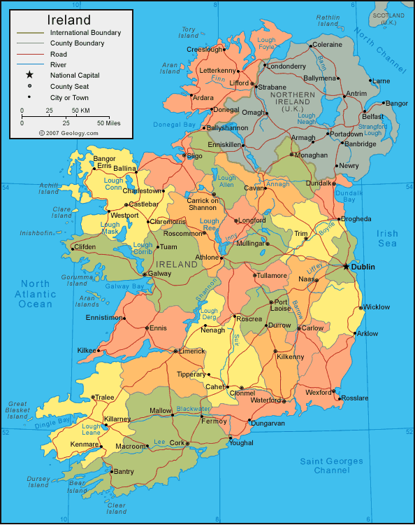
Map of Ireland
The country has a diverse landscape, with rolling hills, lush green fields, and rugged coastlines. The economy is driven by a mix of industries, including technology, pharmaceuticals, and financial services. Agriculture also plays a significant role in the economy, particularly in the production of beef and dairy products. The country also has a rapidly growing tourism industry, with visitors attracted to its rich history and culture, as well as its natural beauty.
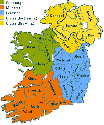
Ireland Provinces Map
Ireland is divided into four provinces: Ulster, Munster, Leinster, and Connacht. These provinces have historical and cultural significance, but they do not have any administrative or governmental functions.
- Ulster: located in the north of the island and includes the counties of Antrim, Armagh, Down, Fermanagh, Londonderry, and Tyrone.
- Munster: located in the south of the island and includes the counties of Clare, Cork, Kerry, Limerick, Tipperary, and Waterford.
- Leinster: located in the east of the island and includes the counties of Carlow, Dublin, Kildare, Kilkenny, Laois, Longford, Louth, Meath, Offaly, Westmeath, Wexford, and Wicklow.
- Connacht: located in the west of the island and includes the counties of Galway, Leitrim, Mayo, Roscommon, and Sligo.
The largest cities in Ireland are:
Here are the 10 most populous cities in Ireland with their population figures:
- Dublin: The capital and largest city of Ireland, with a population of over 1.2 million people.
- Cork: The second-largest city in Ireland, with a population of around 125,000.
- Galway: A city on the west coast of Ireland, with a population of around 75,000.
- Limerick: A city in the mid-west of Ireland, with a population of around 100,000.
- Waterford: A city in the south-east of Ireland, with a population of around 50,000.
- Drogheda: A town in the east of Ireland, with a population of around 40,000.
- Dundalk: A town in the north-east of Ireland, with a population of around 40,000.
- Belfast: It had a population of 345,418 in 2021.
- Derry:
- Wexford:
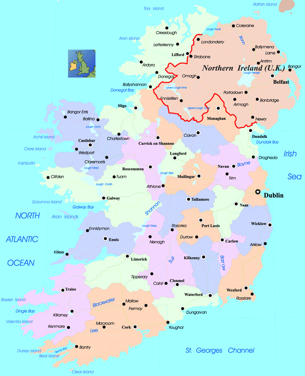
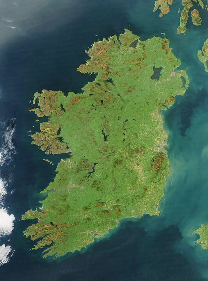
Ireland Satellite Map
Author: Arif Cagrici – Head of Digital

